The Model, Checked Against The Building That Was Built.
Upload a laser scan of the site. SpaceDesignX lines it up with the model and measures every element against the real surfaces, so you know what stands where it was drawn, what is off, and by how much.
From A Scan To A Verdict On Every Element.
- Upload the scan as LAS, LAZ or E57, or as a text point file such as XYZ or PTS
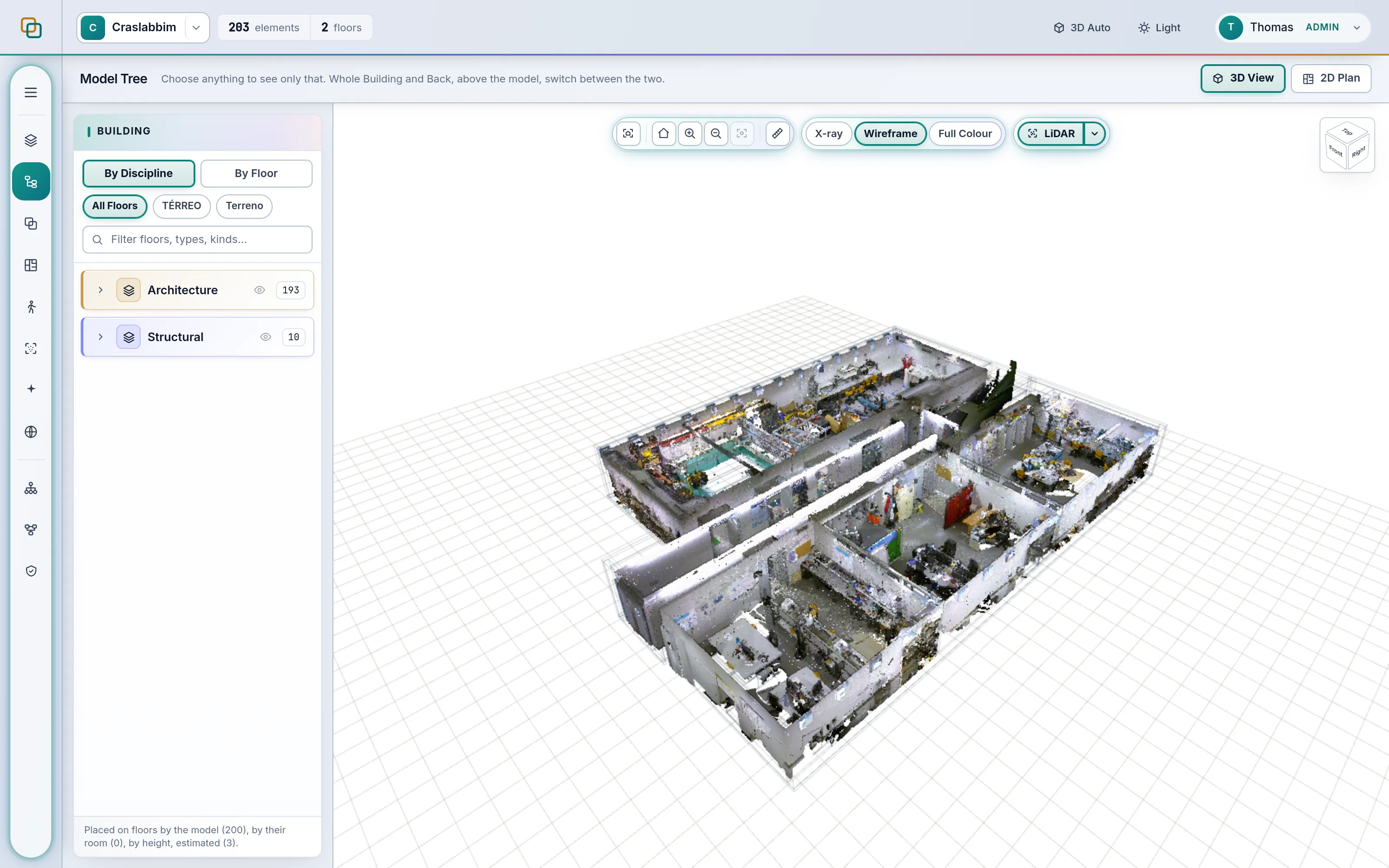
- SpaceDesignX prepares it for the browser; a 26.8 GB scan of 585 million points opens as an 850 MB, 77 million point layer beside the model
- The scan is aligned to the model automatically, and you can fine-tune the alignment by hand
- Each element is measured against the scan points near its drawn surface
- Each element gets a result against a tolerance your team sets, not a number fixed in the software
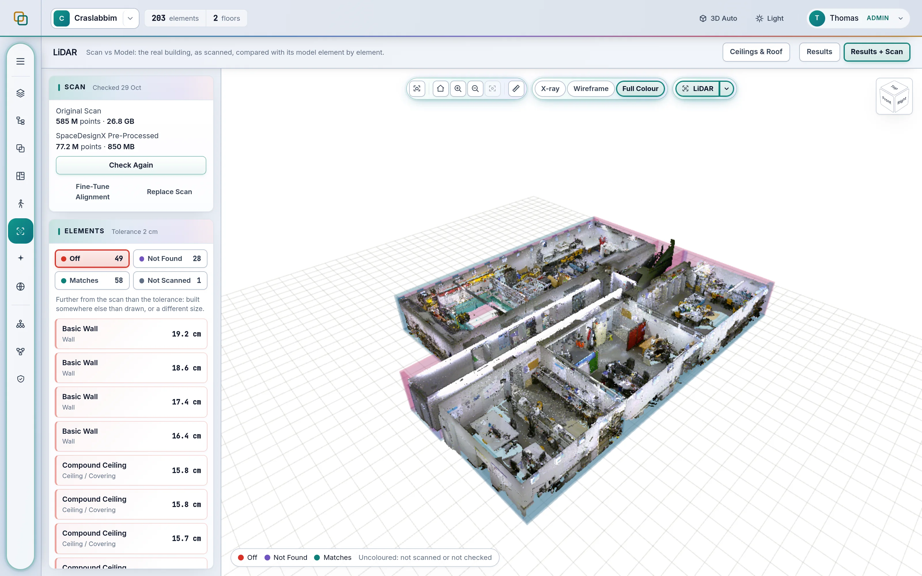
Four Answers For Every Element.
Matches
The scanned surface lies within your tolerance of the drawn one.
Off
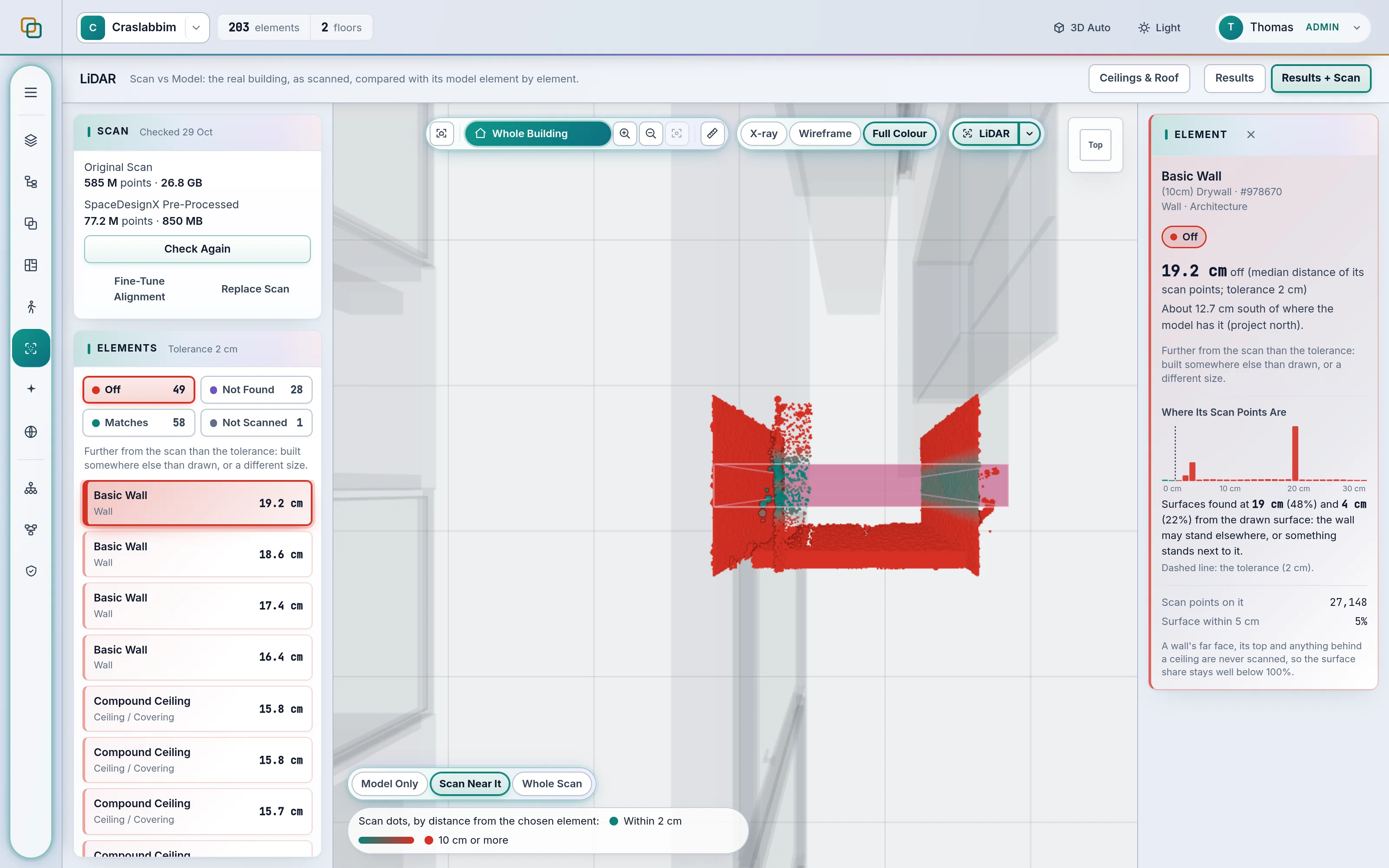
Built somewhere else than drawn. The distance and the direction are shown, for example 12.7 cm south of where the model has it.
Not Found
The scan covers where the element should be, but no scan points are on it. It may be missing, or hidden from the scanner.
Not Scanned
The scan covers too little of this element to judge it, so no verdict is given.
One Element, In Detail.
Choose any element and see how far its scan points sit from the drawn surface and where they cluster. Distance colours paint the scan around it, from on-tolerance to 10 cm or more. Model Only, Scan Near It and Whole Scan views let you compare the design and the site in the same 3D viewer.
Everyone Who Needs To Know What Was Built.
Site engineers and surveyors verify finished work against the design. BIM and quality managers check progress and accuracy as the site advances, replacing the scan as new ones arrive. Owners see where the built building departs from the drawn one before something does not fit.
Common Questions.
How Does LiDAR Scan Vs Model Verify What Was Built?
SpaceDesignX aligns a laser scan (LAS, LAZ or E57) with the model and measures every element against the scanned surfaces. Each element is marked Matches, Off, Not Found or Not Scanned against a tolerance your team sets, and Off elements show the distance and direction.
Which File Formats Does SpaceDesignX Support?
IFC models (IFC2X3 and IFC4), BCF 2.1 for issues, and LAS, LAZ or E57 laser scans, plus text point files such as XYZ and PTS. Scaled plan sheets leave as PDF.
What Does SDX TrueSpace Check?
SDX TrueSpace covers quality from the model to the finished building. Every model version is checked for geometry clashes, elements duplicated across files, and element data that is missing or inconsistent. Findings are classed, scored and assigned to an owner. As-built checks compare the model with a laser scan of the real building.
Can We See Whether Quality Improves Between Model Versions?
Yes. Comparing two runs shows which clashes are new, which were resolved and which are unchanged, and the Analytics page shows clashes per version and issues over time.
See Your Own Model In SpaceDesignX.
Send us a model you know well. We will walk you through it live in the products that fit your work: approvals, clash detection, defects and handover, or carbon.